Finapp CRNS: measure fuel load for bushfire and wildfire risk
OVERVIEW
PRODUCTS
LOCATION
Sensors Used
The objective of the project is to determine if it is feasible to autonomously collect soil moisture, temperature and relative humidity, vapour pressure defecit (VPD), and fuel load moisture data in remote locations. This data can then be used as the ground-truth observations to validate and calibrate satellite-based vegetation moisture estimates. These deployments will be used to develop models that will better inform fire behaviour models and improve the understanding of fire conditions that can occur within the native forest estate. Within this project, the Finapp has been deployed to supplement the sensors installed to investigate the ability to measure a wider area of soil and surface biomass moisture.
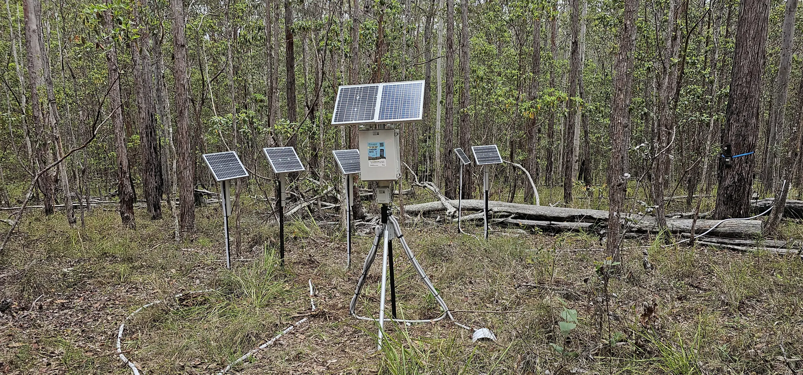
ICT International has provided fuel, soil, and microclimate monitoring stations for use in the ground calibration across 9 sites and 3 geographical locations (on the Mid North Coast and South Coast of NSW). These sensors include:
- Finapp CRNS for Soil Moisture Measurement
- ICT International Fire Hazard & Environmental Monitoring Station with:
The combination of these sensors allows for high quality data to be used within the Eratos and Senaps modelling environment alongside satellite and public datasets to build vegetation moisture estimates.
About the sensor and other technologies used
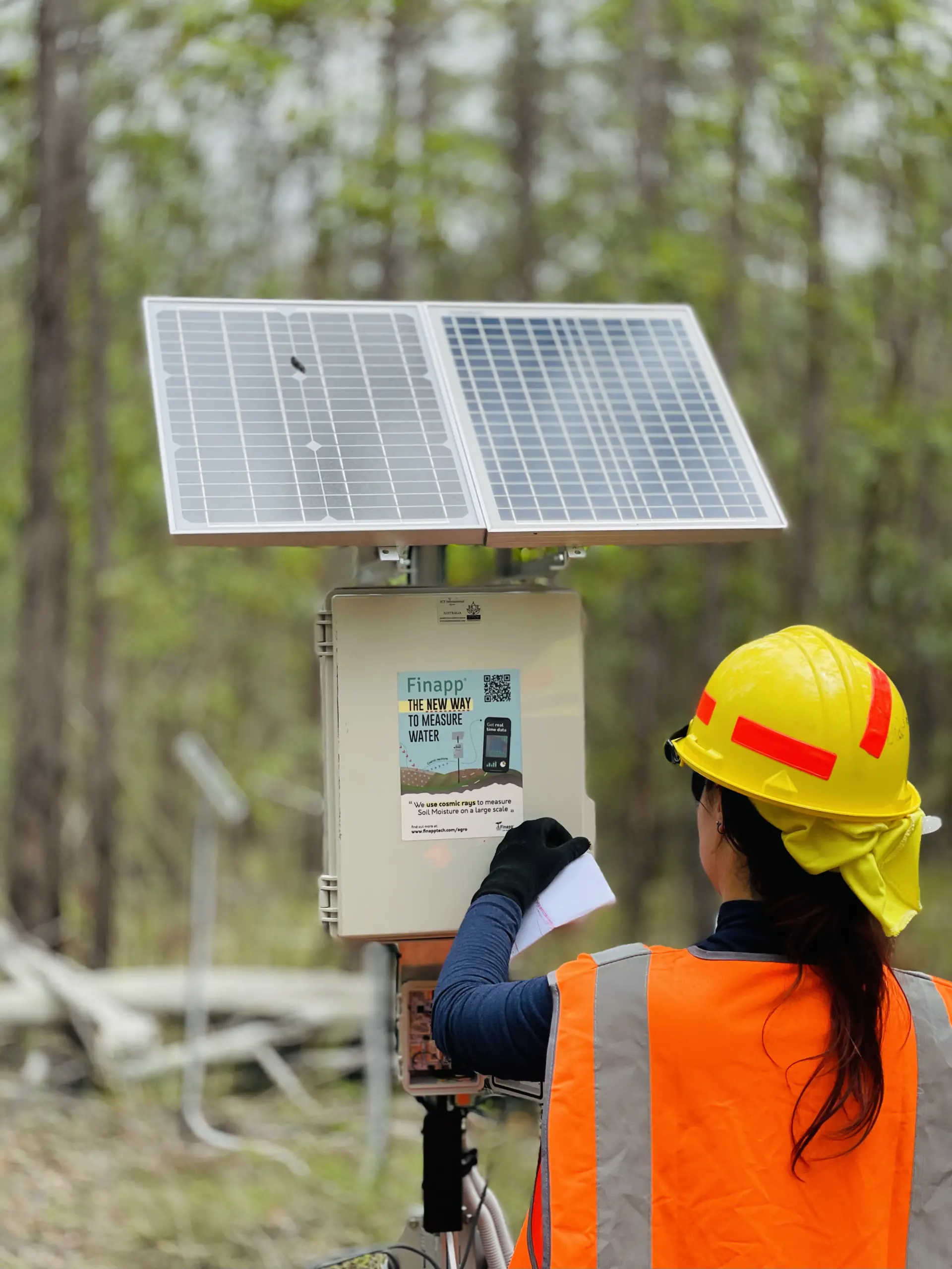
Finapp CRNS
The Finapp Cosmic Ray Neutron Sensor measures incoming and returning neutrons that have interacted with the water within the soil moisture content. From this, calculations are performed that convert these counted returning muons (in the case of the Finapp) into soil moisture content values.
More details on how Neutron Sensing Technologies measure soil moisture can be found here.
Fire Hazard & Environmental Monitoring Station
The Fire Hazard & Environmental Monitoring Station is a highly customisable solution for the measurement of key busfire and wildfire risk parameters. Connecting the measurements from the CS506 10hr Fuel Moisture Sensor, the MP406 Soil Moisture Sensor, the ATH-VPD Sensor for Air Temperature, Relative Humidity, Atmospheric Pressure and VPD, the SP-212 for Solar Radiation, and the TR4-RG 0.2mm Rain Gauge, the Fire Hazard Monitoring Station brings all the data simultaneously to the Eratos dashboard for informed decision making and integration into Senaps models.
Extended power system
Due to the forest canopy, the Finapp and MFR-Node have required a split solar panel system. These systems are used when there is limited clear sky, and a single solar panel is not able to provide sufficient charge. The solar panels are angled so that they capture the maximum sun available. Wired in series with a blocking diode, the two solar panels provide an extended charging time compared to a single solar panel installation.
Network and Data Solutions
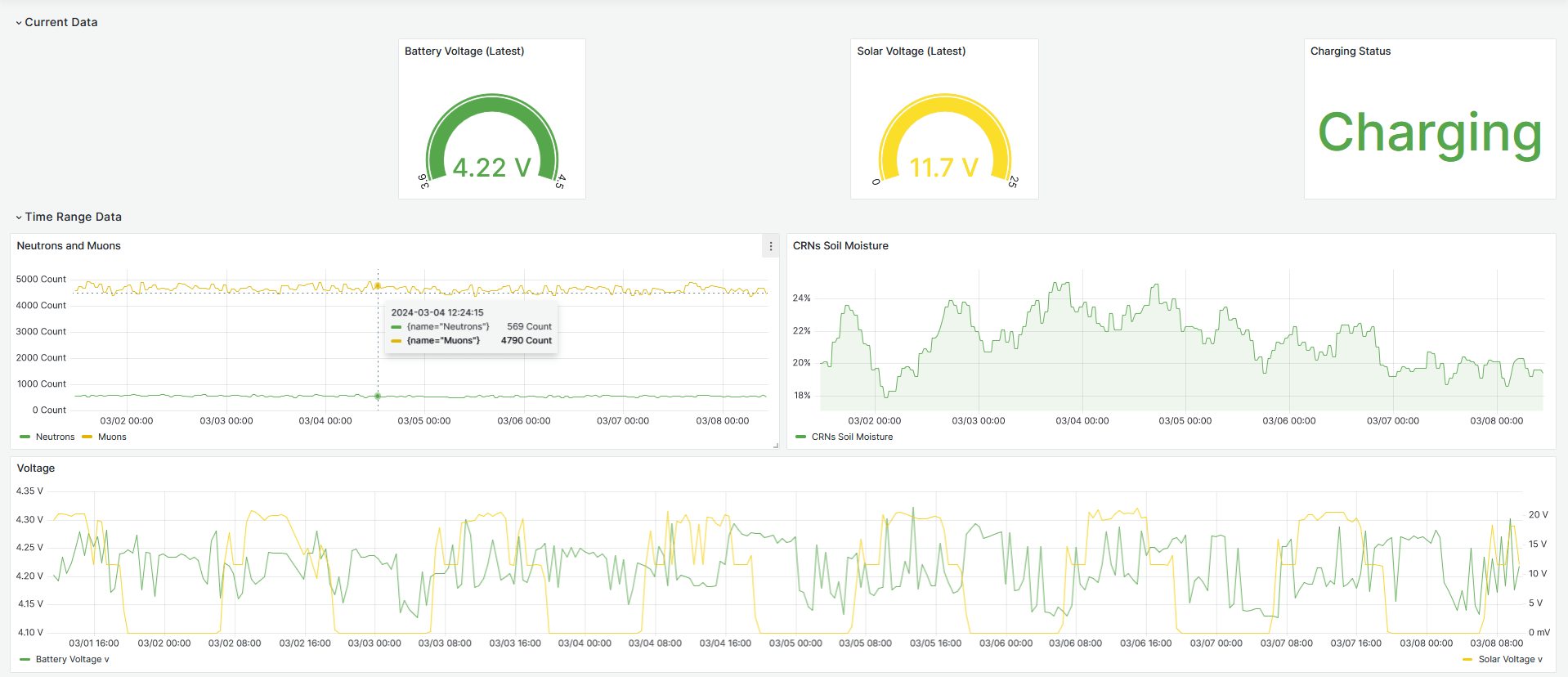
Data from the network of Fire Hazard & Environmental Monitoring Stations is transmitted over the Telstra CAT-M1 network to the Eratos platform (including Senaps database). Data is stored within the Senaps database and is presented for near real time visualisation in the Eratos Viewer dashboard. Eratos additionally provides a platform for ingesting ICT International sensor data alongside a vast catalogue federated open-source geospatial datasets. The Eratos developer environment allows for the creation of modelled data products which can then be applied in the calibration of remotely sensed datasets.
More details on the Eratos platform and Senaps, and the capabilities within these, can be found as a case study with Eratos.

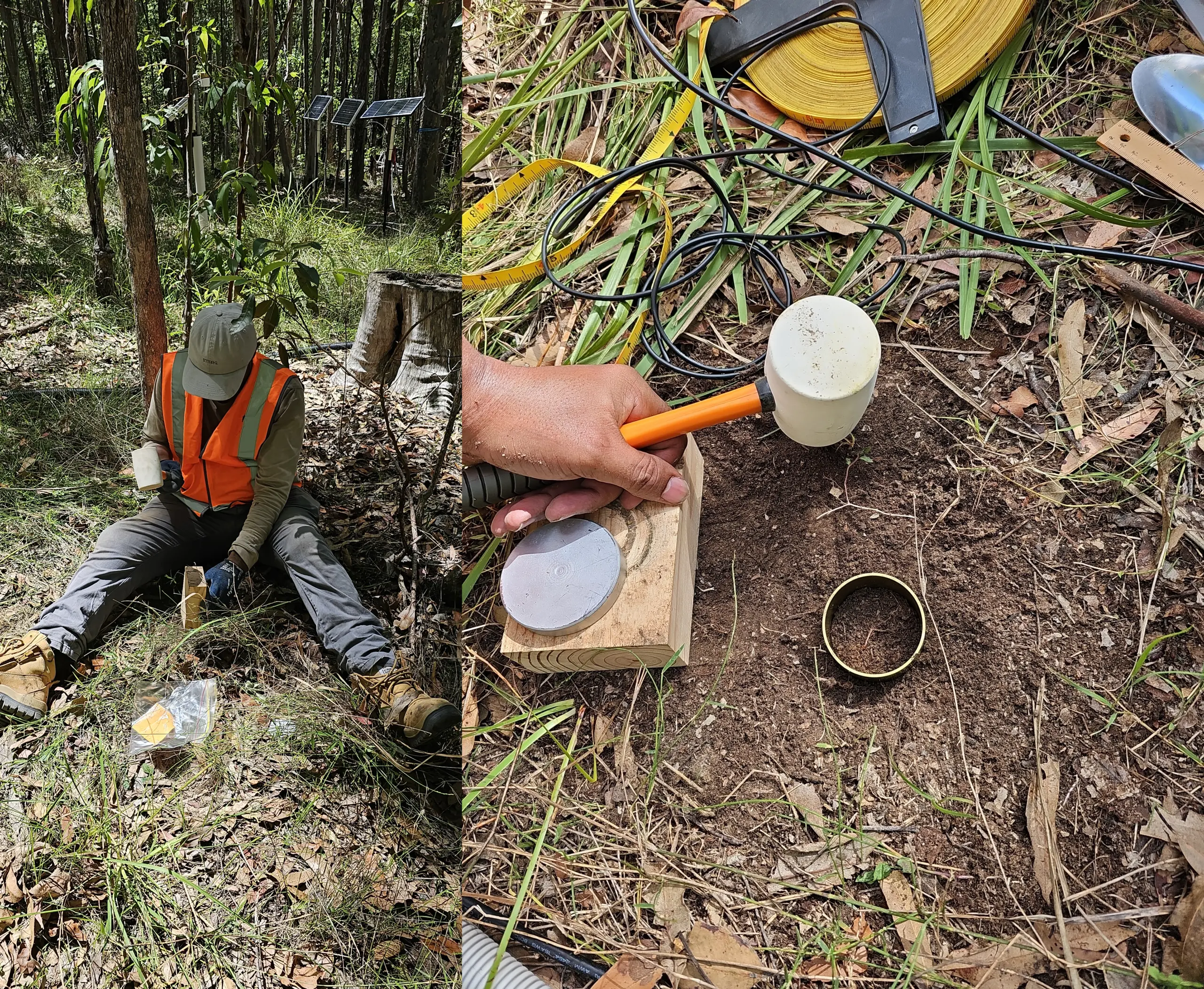
Soil Sampling to Calibrate the Finapp
To calibrate the Finapp to Australian environments, a total of 36 soil samples were collected for bulk density, gravimetric and volumetric soil water content calculations.
The soil samples were collected from 3, 10, and 35 m away from the Finapp, at two depths (0-6, and 6-12 cm) and at every 60 degrees from each distance. Additionally, litter samples (30 cm by 30 cm) were collected from 18 points (every 60 degrees) at 3, 10, and 35 m from the detector. The soil samples were dried at 105° C oven for 24 hrs while the litter samples were dried at 40° C for consecutive three days.
There will be a repeat process undertaken after a period of heavy rainfall to provide a high soil moisture content calibration profile, and again after a period where the soil moisture content is expected to be very low. With the three sample sets completed, a comprehensive calibration offset can be integrated into the Finapp.
Example Dashboard
The Eratos dashboard enables the users to assess the conditions that are critical for planning of prescribed burns, forming the fire hazard rating, and bushfire behaviour prediction.